mileage: 17 miles
 |
| Bixby Creek Bridge |
I drove through the beautiful dirt road to the trail head about 6.5 miles in.

The first part of the trail is nothing short of idyllic. Sun soaking through the giant Redwoods, green everywhere hugging the the small river. I had some time to test my Sawyer mini water filter, even though I drink this water all the time as is, I didn't need to look like a fool by using it for the first time on the PCT.


After crossing the Little Sur River, the trail climbs steeply up Dani Ridge.


The path eventually crossed a private dirt road, littered with "NO TRESPASSING" signs. Most of this land has been owned by El Sur Ranch since 1834. They are serious about enforcing trespassing and I continued on the trail, even though I'd heard it was pretty bad and not maintained. I found out later that the trail is quite bad. Over gown, tons of poison oak, washouts, endless amounts of ticks, and it's totally exposed. I didn't get any pics of the poor trail because I was busy bushwhacking and checking my legs for ticks, but here are some pics of the change in landscape as I approached Pico Blanco.


The mountain has massive limestone deposits, and the South and West slopes resemble desert environments. I was quite tired of the over gown trail, so I climbed up the ridge to the dirt road and began my ascent of Pico Blanco. Last time I tried this, I went straight up the South face for hours until it was too steep to climb. Having found the road, this time was much easier, but I was out of water, sun-burnt and very tired. I was determined to make it to the summit.
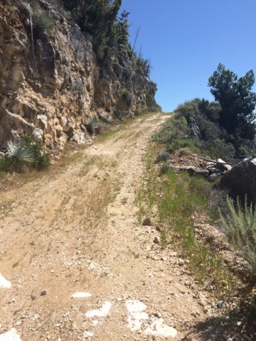

 |
| The road I've been climbing in the distance below. |
I climbed and baked in the sun for over an hour, and was really tired. I kept seeing the top of rocky cliffs above me, which I was nearly certain was a false summit. I finally reached the end of the road, finding a weather antenna, and I began climbing the ridge again.

 I seriously thought I was climbing to a false summit, when I suddenly saw a small pipe sticking out of the rock It was the summit registry!!! I was at the top!!! I yelled out in triumph, it was incredibly rewarding after a long, hard hike. I signed the register, and looked around at the stunning 360 degree panorama of beauty around me. I could see as far as Santa Cruz to the North, and Cone Peak to the South, and I could see my mom's house. She lives on a remote ridge in Big Sur, so it was very neat to see it.


 I am in love with the Ventana Wilderness and the PCT has some serious competition for my viewfinder, though I think I'll find a few beauties on the PCT as well.
 |
| fun pic I took near summit |
No comments:
Post a Comment